Although Lawrence’s Appleton campus doesn’t feature any natural outcrops of rock, there are many fascinating geologic stories embodied in stones in the built environment, as well as in the landscape itself. As we celebrate history—we marked the 175th anniversary of Lawrence’s founding during 2022—let's take a journey in Deep Time. (This story originally appeared in the Fall/Winter 2022 edition of Lawrence magazine.)
Read about Marcia Bjornerud's latest book, Geopedia: A Brief Compendium of Geologic Curiosities
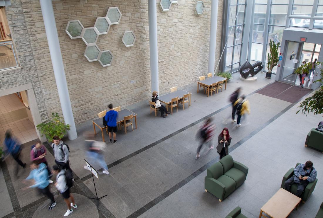
Stop 1: Hiett Hall 4th floor lounge
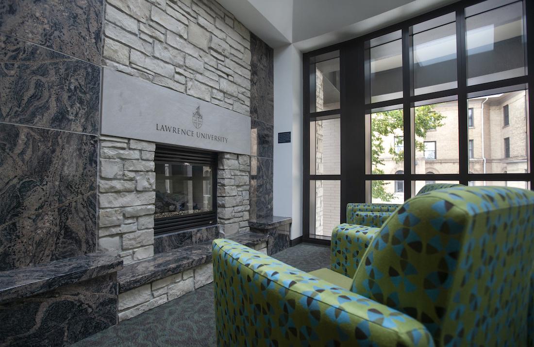
We’ll start our tour far back in the mists of the geologic past, with the beautiful stone panels around the fireplace in the 4th floor lounge of Hiett Hall. This is the Morton Gneiss, a high-temperature metamorphic rock quarried in southwestern Minnesota, part of an ancient continental fragment exposed in the Minnesota River Valley. The Morton Gneiss is famous to geologists because it once held the record as the oldest known rock in the world. The oldest parts of this rock formed 3.5 billion years ago, during the Archean eon of Precambrian time, long before the dinosaurs, in fact before there were any plants and animals on land, or oxygen in the atmosphere—and probably even before Earth had settled into the habit of plate tectonics.
Morton Gneiss was a popular building stone in the first decades of the 20th century, and many buildings throughout the U.S., including the Adler Planetarium in Chicago, were clad in this venerable rock. The panels in the Hiett fireplace once served as the facing stone of the J.C. Penney building in downtown Appleton. When that building was demolished in 2002—the same year Hiett Hall was under construction—faculty in the Geology (now Geosciences) Department asked the owner of the building to donate the polished stone to the university. The slabs were recut and incorporated into the impressive fireplace.
Even from the few panels here, one can infer a significant amount about the early geologic history of the North American continent. Using a basic geologic concept called the “principle of cross cutting relationships” (the idea that if feature A is cut by another feature B, A must be older than B), it is possible to “read” the sequence of events that formed this rock. Look for inclusions (isolated bits of older rock engulfed by younger igneous rock), foliations (layering defined by aligned minerals), veins (planar intrusions), pegmatite masses (partially remelted areas with large crystals), and boudins (pulled-apart blocks).
If you don’t want to think that hard, you can just enjoy the rock aesthetically!
Stop 2: The Rock, on Main Hall Green
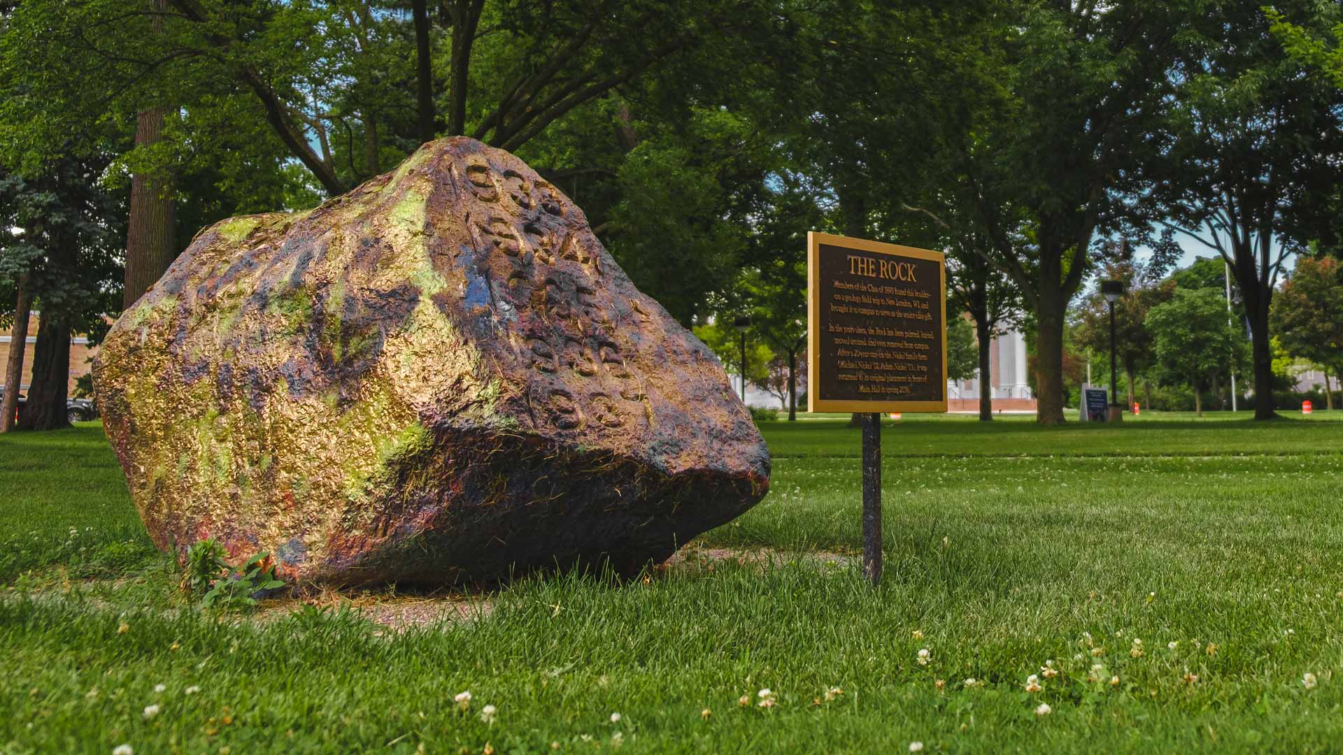
A Lawrence icon, The Rock was originally brought to campus in 1895 by geology students from a field trip in the New London area—an incredible feat, given that the boulder weighs more than two tons. It inspired equally ambitious pranks and hijinks by many subsequent generations of students who repeatedly moved, buried, painted, and hid it—until 1998, when it finally disappeared from campus altogether. Its whereabouts were unknown for almost 20 years until expert sleuthing by students Sarah Axtell ’17 and Jon Hanrahan ’16 led to the rediscovery of The Rock on a local family farm that was home to two brothers who were students at the time of the “rocknapping.” The family agreed that The Rock belonged back on campus, and it was installed at its current site in 2018. Axtell and Hanrahan told the full story of The Rock’s odyssey in their podcast, No Stone Unturned.
At the time of its homecoming, The Rock was cleaned of the many layers of paint it had accrued, and for a few weeks its natural granitic exterior was exposed for the first time in decades. Geoscience faculty fortunately examined the boulder before it was painted again and noted its similarity to rocks in Waupaca, Shawano, and Menominee counties that are part of the “Wolf River Batholith,” a complex of mainly granitic intrusions that represent subterranean magma chambers that fed a chain of volcanoes in Wisconsin 1.45 billion years ago. Granites of this same age probably occur in the deep subsurface beneath Appleton and the Lawrence campus (below the layered sedimentary rocks described at the next stop). Long after those granites had crystallized, and the volcanoes above them had eroded away, a Pleistocene glacier must have picked up a chunk and left it near New London, where it caught the eye of members of the class of 1895. For now, we hope, The Rock has no further travel plans.
For more information about the The Rock, read here
Stop 3: Main Hall exterior
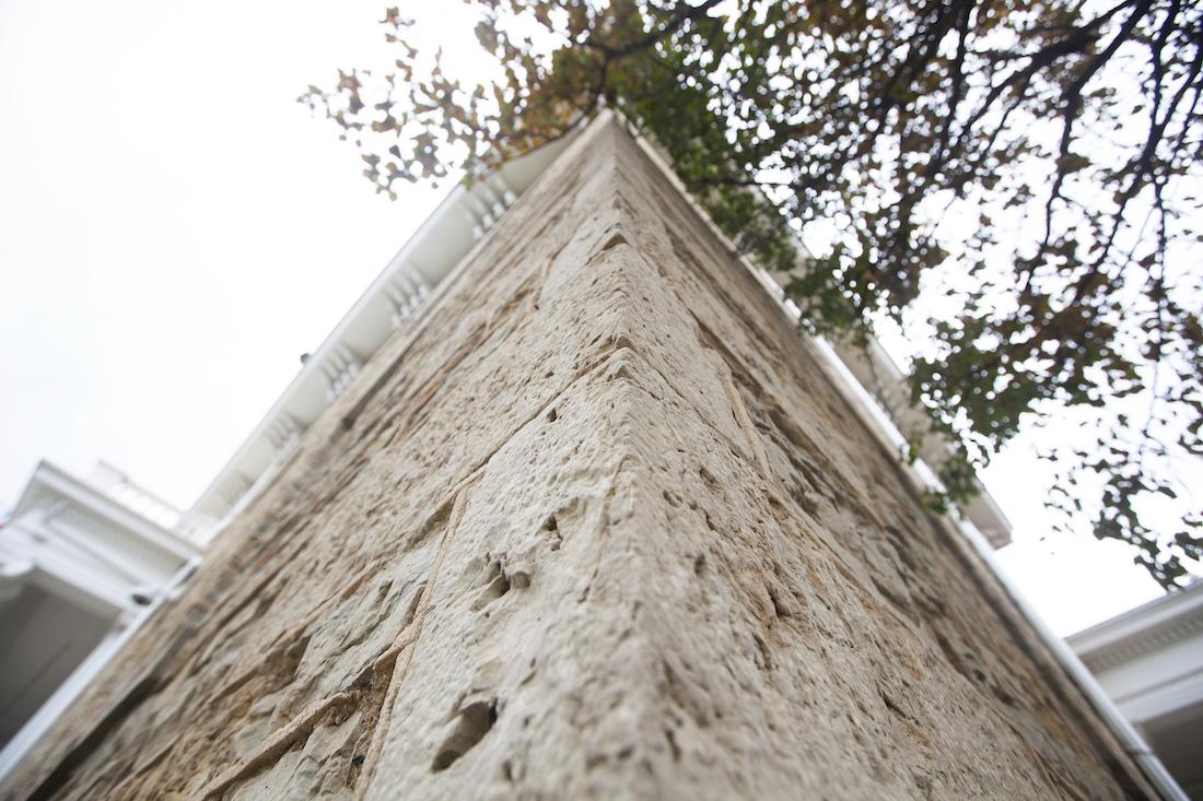
Dedicated in 1854, Main Hall is Lawrence’s oldest surviving building and was the first building in Appleton to be added to the National Register of Historic Places (in 1974). The rock used for its distinctive exterior—ivory-colored dolostone, a cousin of limestone—is of course far older, though its origins are somewhat elusive.
A 1953 article in the Lawrence alumni magazine marking the centennial of Main Hall stated that the stone had been quarried from the riverbed immediately below campus, an assertion that also appears in Marguerite Schumann’s 1957 history of Lawrence, Creation of a Campus. This was questioned, however, by Lawrence history professor Charles Breunig in his 1995 book, A Great and Good Work: A History of Lawrence University. Breunig cited documents indicating that the university had paid laborers in the early spring of 1853 to “work at a stone quarry” and “repair the road to the quarry,” suggesting a source away from campus.
From the Cambrian explosion to climate change, you’ll explore Earth’s long history to help understand its future
University archivist Claire Cannell recently located the original stone mason’s handwritten contract, which can be viewed here. It does not mention the origin of the stone.
Breunig speculated that the stone may have come from quarries at what is now High Cliff State Park on the northeast shore of Lake Winnebago, but the rock there is Silurian dolostone, part of the Niagara series, which tends to be more massive, uniform, and barren of fossils (as you will see at Stop 4). In contrast, the stone on the exterior of Main Hall—as well as Brokaw—is flaggy, slightly clayey, and commonly quite fossil-rich.
A variety of fossils can be seen if one examines the rocks closely. Most of the stones in the building were laid with their bedding in horizontal position, so that beds are seen in cross section, and in these stones, it is difficult to discern fossils. Look for larger blocks in which the flat bedding planes face outward; on many of these surfaces, fossils of marine organisms can be found. These include brachiopods (also called lamp shells), stems of crinoids (stalked organisms related to starfish), bryozoa (branching, coral-like creatures) and rare trilobites (extinct arthropods—and Wisconsin’s official state fossil). “Trace fossils”—burrows and crawling tracks—can also be observed on many of these blocks. This particular assemblage of fossils is typical of rocks of Ordovician age (ca. 450 million years old), which form the bedrock in the Fox Cities area. Similar stone is excavated today at two quarries that were operational in the 19th century: one near the town of Mackville north of Appleton and one near the Fox River in Kaukauna, downstream from the city. It is possible that the Main Hall stone came from one of these, or from a smaller, now-forgotten quarry closer to campus.
A free online guide to fossils in Wisconsin’s bedrock—including some seen in the walls of Main Hall—can be found here. A bedrock geologic map of Wisconsin is available at: https://wgnhs.wisc.edu/catalog/publication/000390/resource/m067 (On this map, the Ordovician rocks used in Main Hall—Sinnippee Group—are shown in green, and the Silurian dolostones of the Niagaran Escarpment are in gray).
Stop 4: Science Atrium
The Atrium connecting Steitz and Youngchild halls hosts a number of geologic features spanning a billion years of geologic time.
The walls display the classic look of Silurian dolostone from the Niagara Escarpment, about 400 million-years-old, a bit younger than Main Hall’s rocks. These rocks probably came from quarries in the area between Fond du Lac and Milwaukee. Silurian dolostone is used on the exteriors of many other campus buildings including Briggs, Memorial, and Kohler Halls, Mudd Library, the Quad buildings, and the Warch Campus Center. Rocks at Lawrence’s Björklunden campus are approximately the same age but were deposited close to an ancient reef complex on the Silurian sea floor and contain abundant fossils, especially corals.
The floor of the atrium is made of feldspar-rich gabbro, a coarse-grained igneous rock, in both polished and unpolished slabs. Although we have not been able to locate records of its source, such stone is quarried in northeastern Minnesota, where, 1 billion years ago, magmas welled up in a great tear in the Earth’s crust known as the Midcontinent Rift. Some of that magma erupted at Earth’s surface and formed a thick sequence of lava flows that are exposed today on the North Shore of Lake Superior in Minnesota, at Copper Falls State Park in Wisconsin, and in the Porcupine Mountains and Keweenaw Peninsula in the Upper Peninsula of Michigan. The high density of the gabbros and lavas caused the crust in the region to sag, creating the topographic basin that forms Lake Superior, which holds 10% of all of the planet’s fresh water.
A sculpture in the southeast corner of the Atrium is labeled “Tennessee Marble,” though it is technically just a black, organic-rich limestone. This distinctive rock has been quarried at Clinch Mountain northeast of Knoxville and is of middle Cambrian age (ca. 500 million years), making it a bit older than the stone of Main Hall (and about the same age as sandstones at Wisconsin Dells and elsewhere around this state).
Finally, pay respects to the two cycad plants in the northwest and northeast corners. This gymnosperm species has changed little since the Cretaceous Period 80 million years ago and would have been a favorite snack of herbivorous dinosaurs. The LU campus also hosts at least one representative of another Cretaceous species—a ginkgo tree that stands between Raymond House and Kohler Hall.
Stop 5: Hurvis Crossing
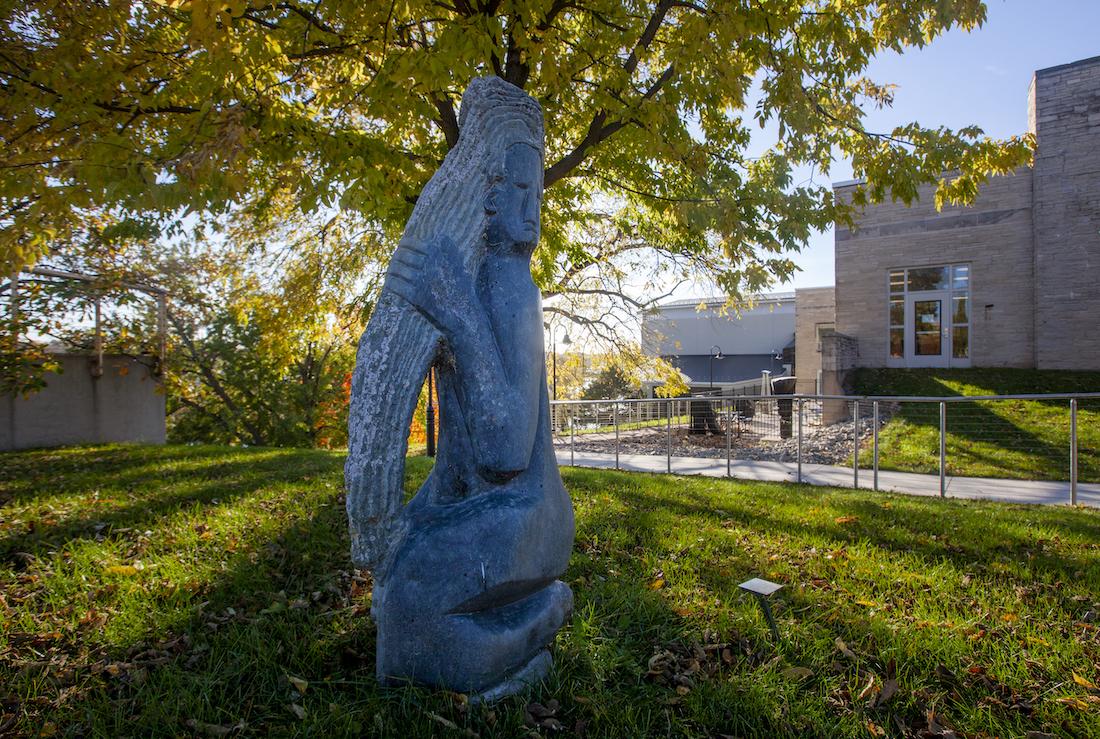
The stone sculptures on either side of the footbridge over Lawe Street are examples of the Shona artistic tradition of Zimbabwe, which has roots as far back as 1200 AD and experienced a renaissance in the 20th century. Geologically, Zimbabwe is a sister to the Lake Superior region—part of an ancient continental shield with rocks dating from the Archean eon. Although we do not know the exact locations where the stones for these sculptures were quarried, the rocks are probably older than 2.5 billion years. Both pieces were carved from varieties of basalt (although the plaque near the sculpture of the woman with long hair says it is serpeninite).
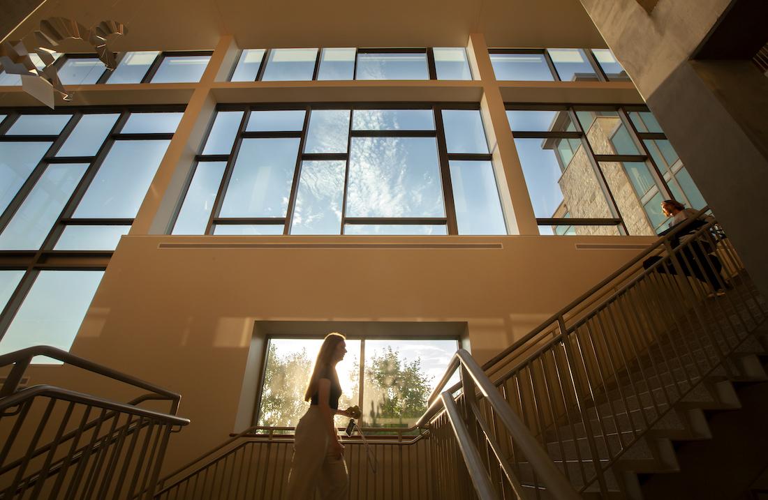
Stop 6: Warch Campus Center
As you enter the campus center, say hello to more Silurian dolostone on the exterior of the building, and perhaps add a word of gratitude to all dolostones and limestones—carbonate rocks—for storing 99% of the carbon dioxide ever exhaled by Earth’s volcanoes over geologic time. The precipitation of carbonate rocks in shallow ocean environments, most of it by marine organisms, is the planet’s long-term carbon sequestration scheme. Organisms ranging from scallops, clams, and corals to tiny zooplankton combine calcium ions in seawater with a dissolved form of carbon dioxide to form calcite (CaCO3), thereby locking the gas away in mineral form over geologic timescales. If not for this biogeochemical service, Earth would be a runaway greenhouse planet like its sister Venus. Unfortunately, the process is far too slow to keep up with human-generated CO2 emissions. But we should all thank carbonate rocks for making Earth such a hospitable place for hundreds of millions of years.
We can use the main Campus Center stairway as an analog geologic time scale. If the entry level is the present day, and the base of the stairs outside the Commons represents the formation of the Earth 4.56 billion years ago, then each step represents about 80 million years. So, as your foot leaves the top step, you’ve already passed the beginning of the Ice Age, 3 million years ago. One step down, you are in the middle Cretaceous Period of the Mesozoic Era (80 million years ago), when dinosaurs munched on cycads and ginkgoes. Just before you reach the first landing, you are in the Devonian Period of the Paleozoic Era (360 million years ago) when the Appalachians were newly formed. On the landing (step #5), you are in the Silurian (400 million years ago) when the dolostone of the Niagara Escarpment was formed and a coral reef thrived near what is now Björklunden.
Another step down (#6) takes you to the Ordovician (450 million years ago) when the dolostone of Main Hall was deposited, the seafloor teamed with marine organisms, and the first plants began to colonize the land. One more step (#7) and you have passed through the Cambrian (which began 543 million years ago) when black limestone was deposited in Tennessee and golden sandstones in Wisconsin—and animal life burst on the scene in the event called the Cambrian Explosion.
Five more steps down (#12), you have reached 1 billion years ago, in the Middle Proterozoic Era of the Precambrian, when what is now the Lake Superior basin was a seething sea of lava and the rocks of the Science Hall Atrium floor were formed.
Pass the second landing (#24) and go seven more steps (#31); you are now at 2.5 billion years ago, in the Early Proterozoic Era, at the time of the Great Oxygenation Event when free oxygen first arose in the atmosphere (thanks to photosynthesizing microorganisms).
Thirteen more steps down (#44) you are at 3.5 billion years ago, when the Morton Gneiss in the Hiett Hall fireplace formed.
At the base of the steps, you have reached the time of the formation of Earth. Pause for a moment to recover from that journey, and return to the present day. Exit through the doors outside Andrew Commons and descend to the path along the river.
Stop 7: River path
As you start down the path, look left at the hillside behind the metal steps that exit from Somerset Room. As a way to control erosion, the slope has been covered with glacially-transported cobbles (they may be partly covered by vegetation in summer but are nicely visible in spring and fall). The variety of rock types reflects the geologic diversity along the path of the Green Bay ice lobe as it flowed down from Ontario, through the Upper Peninsula and into eastern Wisconsin. See if you can identify rocks encountered earlier on this tour: dolostones, granites, gabbros, and gneisses.
Now walk eastward along the river path. This natural terrace—it continues west of Lawe Street to the campus garden, the ground level of Briggs Hall and the LU tennis courts—is the flood plain of the Fox River. In general, it is not a good idea to build on a flood plain, which rivers use as “overflow valves” during times of high water. The lower Fox, however, is a highly controlled river, with two dams upstream from campus, one at its outlet from Lake Winnebago in Menasha and the second at Olde Oneida Street.
Following the path downstream (east) you will encounter informational plaques on “Early people of the Fox River” and “The River in Time,” highlighting the long natural and human history of the river. The Fox’s geologic evolution shaped human settlement in two important ways. First, by glacial happenstance, the headwaters of the Fox River near Portage lie within only a mile or so of a stretch of the lower Wisconsin River, a major tributary of the Mississippi. This means that the Fox River provides a connection between the Great Lakes and the entire Mississippi watershed, which includes 40% of the area of the continental United States. Long before Europeans arrived in North America, First Nations peoples used the Fox as a route for trade. In the 1840s, a canal was built at Portage making it possible for steamships to travel all the way from New Orleans to Menasha.
The second extraordinary attribute of the Fox is its longitudinal profile—the change in elevation with distance downstream. Most rivers are steepest in their upstream reaches, and their gradients, or slopes, become gentler toward their mouths. The Fox is the opposite: between Portage and Lake Winnebago, it is a lazy, slow-moving river that drops only 36 feet in 110 miles, for a gradient of 0.33 ft/mile or 0.06m/km. But the Lower Fox from Lake Winnebago to Lake Michigan at Green Bay falls 169 in just 39 miles, a gradient of 4.33 ft/mile or 0.83 m/km. The extraordinary water power of the Lower Fox is what first attracted Amos Lawrence, from a Massachusetts textile milling family, to the area.
The reason for the Fox’s unusual profile is that the lower part of the river is a relatively recent addition. Until about 10,000 years ago, at the end of the Ice Age, the Appleton area was under the bed of a great meltwater lake known as Glacial Lake Oshkosh, which was impounded by ice. As the last ice melted and the lake drained, the channel of the modern river was established, and the river began to cut down through the clayey lake sediments to the level of Lake Michigan. The elevation difference between Main Hall Green and the river path represents the erosive work done by the river over the past 10,000 years.
During this same time, small tributaries to the Fox did their best to keep up with the downcutting done by the main river. In Appleton, many of these creeks have now been rerouted underground, and their valleys are used as public green spaces including Peabody, Jones, and Arbutus parks. Lawrence’s Banta Bowl occupies the channel of one of these “lost tributaries.”
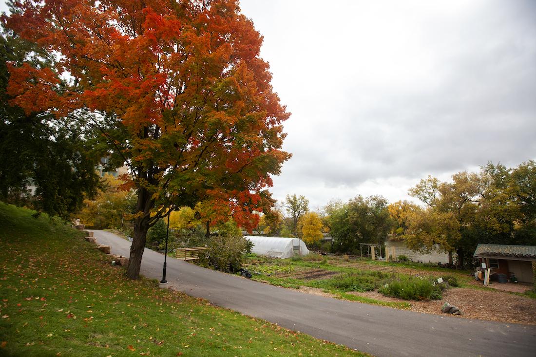
Now retrace your steps and return west on the river path, carefully crossing Lawe Street. Stop to visit SLUG, the Sustainable Lawrence University Garden—a model for sustainable agriculture, which uses compost from the dining halls to nourish the soil, in a closed loop system that mimics natural biogeochemical cycles. Geoscience students have also used the garden as a test site for a carbon dioxide sequestration strategy in which crushed basalt, a common volcanic rock, is added to soils. Calcium-bearing minerals in the basalt react with CO2 in the atmosphere to form calcite, mimicking the geologic carbon cycle (see Stop #5), and other elements in the basalt help to provide nutrients for plants.
Continue past the back of the Wellness Center to the steps east of Briggs Hall. At the top of these steps, turn right, then immediately left to the mulched area between Sampson House and Youngchild Hall.
Stop 8: Rock pile and geoscience department
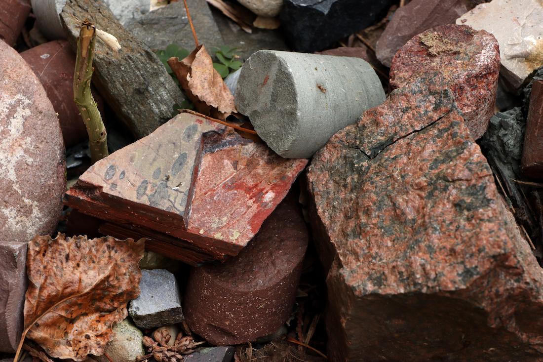
Next to the exterior wall of Youngchild, you will find a treasure trove of rocks from all over North America and beyond—samples collected and studied by geoscience students and faculty but no longer needed. Feel free to take anything that catches your eye—and then stop into the second floor of Youngchild Hall to see if any resident geoscientists are on hand to help identify your rocks.
Marcia Bjornerud

Marcia Bjornerud is the Walter Schober Professor of Environmental Studies and Professor of Geosciences at Lawrence University.